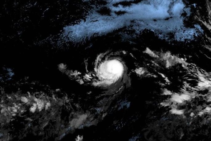
Tropical Storm Kiko has intensified into a Category 2 hurricane, according to the National Hurricane Center (NHC). The storm currently boasts maximum sustained winds of 105 mph and is situated approximately 1,740 miles east of Hilo, Hawaii. Forecasters anticipate that Kiko could develop into a major hurricane within the next couple of days.
The NHC’s latest update, issued at 5 p.m. HST on September 3, 2023, indicates that Kiko is moving westward at a speed of 7 mph. The storm’s trajectory is influenced by a subtropical ridge located to the north, which is expected to guide Kiko’s path over the open waters of the eastern Pacific Ocean.
Forecast and Future Developments
The NHC predicts that Kiko will maintain a steady westward motion for the next two days, before shifting toward the west-northwest in approximately three to four days. Despite its current strength, the hurricane is forecasted to remain over the ocean, with no weather watches or warnings currently in effect for land areas.
As Kiko approaches drier air and cooler waters in the coming days, forecasters expect it to continue gaining strength until encountering these conditions. The storm, which formed on September 1, 2023, marks the 11th named storm in the Eastern North Pacific this year and is projected to maintain hurricane status for at least the next five days.
The development of Hurricane Kiko underscores the ongoing activity in the Pacific hurricane season, and the NHC will continue to monitor its progress closely.