BREAKING: New forecasts indicate that New England may be on the brink of a colder-than-average winter starting this December. Meteorologist Dan Leonard from The Weather Company has just announced that early December could see a significant temperature drop, paving the way for a winter season that local residents should closely monitor.
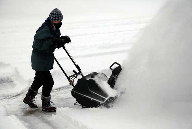
As New Englanders brace for the season, Leonard emphasizes that after several disappointing winters, the odds for a cold and snowy 2025-26 are higher than usual. Boston has experienced a snowfall deficit in recent years, requiring the last three winters combined just to match a typical season’s total. Worcester has not recorded an average snowfall for four straight years.
Meteorologists are closely watching key climate patterns that could influence this year’s weather. Currently, the Pacific Ocean temperatures indicate a La Niña phase, which historically can lead to colder conditions in northern states, including New England. Leonard remarked, “Occasionally La Niña brings a lot of cold and a lot of snow.” However, he noted that warmth from the Southeast could also disrupt this trend, leading to warmer winters.
The potential for winter storms is high, but their snowfall outcomes depend heavily on temperature variations. The Eastern Pacific Oscillation (EPO) is currently in its negative phase, which can steer milder air into the Northeast. Additionally, warmer waters in the Atlantic could add fuel for storms, making the forecast even more complex. Leonard explained, “Warm waters in the Western Atlantic are more fuel for storms,” suggesting that while storm potential exists, the outcomes remain uncertain.
A critical factor in this winter’s weather will be the behavior of the polar vortex. Leonard indicated disruptions to this atmospheric phenomenon could allow Arctic air to spill south, potentially coinciding with coastal storms, leading to significant snowfall. “You may have very mild weather for a long stretch, and then suddenly the floodgates open,” he said.
Another key player is the North Atlantic Oscillation (NAO), which could dictate the severity of winter storms. Leonard noted that when high pressure builds near Greenland, cold air gets funneled southward, setting the stage for potential nor’easters. “When you see high pressure building over Greenland or northern Canada, that’s when you think: big cold and snow could be on the way,” he said.
While Boston’s winters have warmed since 1970, variability in snowfall has increased, with average snow totals rising despite higher temperatures. “Expect a lot of variability,” Leonard cautions, indicating that even a typical winter could be a dramatic change after several quiet seasons.
WHAT TO WATCH FOR: As December approaches, New Englanders should stay tuned. With La Niña influencing storm chances and several atmospheric patterns in play, the region might face a more active winter than in recent years. Residents should prepare for fluctuations in weather and be ready to adapt to whatever winter brings.
The outlook for 2025-26 is developing rapidly, and its implications could impact travel, holiday plans, and local economies. Stay informed as forecasters continue to monitor these crucial updates. Share this news with friends and family to keep everyone in the loop as winter approaches!


