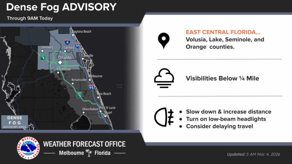
URGENT UPDATE: Central Florida is grappling with a dense fog advisory this morning, creating hazardous driving conditions. The fog, reported by the National Weather Service (NWS) Melbourne, is expected to lift by 9 a.m., allowing for clearer skies as the region transitions to warmer temperatures.
Residents of metro Orlando can anticipate a high of approximately 84°F later today, while those in Daytona and Melbourne will see temperatures peaking in the high 70s. However, be cautious of isolated showers moving onshore, particularly south of Cape Canaveral, which may impact outdoor activities.
In addition to the fog, a high risk of rip currents is in effect at all Atlantic beaches across Central Florida today. Beachgoers are advised to remain vigilant and heed safety warnings. Small craft operators should exercise caution, as offshore Atlantic waters are reporting seas reaching up to 6 feet.
This weather event is significant, impacting morning commutes and outdoor plans for many in the region. The combination of fog and potential rain underscores the need for careful travel and beach safety today.
As conditions develop, stay tuned for updates from local authorities and the NWS, ensuring you have the latest information on Central Florida’s weather.