UPDATE: Central Indiana is bracing for significant snowfall, with accumulating snow expected from Thursday night into early Friday. As temperatures plunge into the middle 20s and winds gust, residents are urged to prepare for potentially hazardous travel conditions.
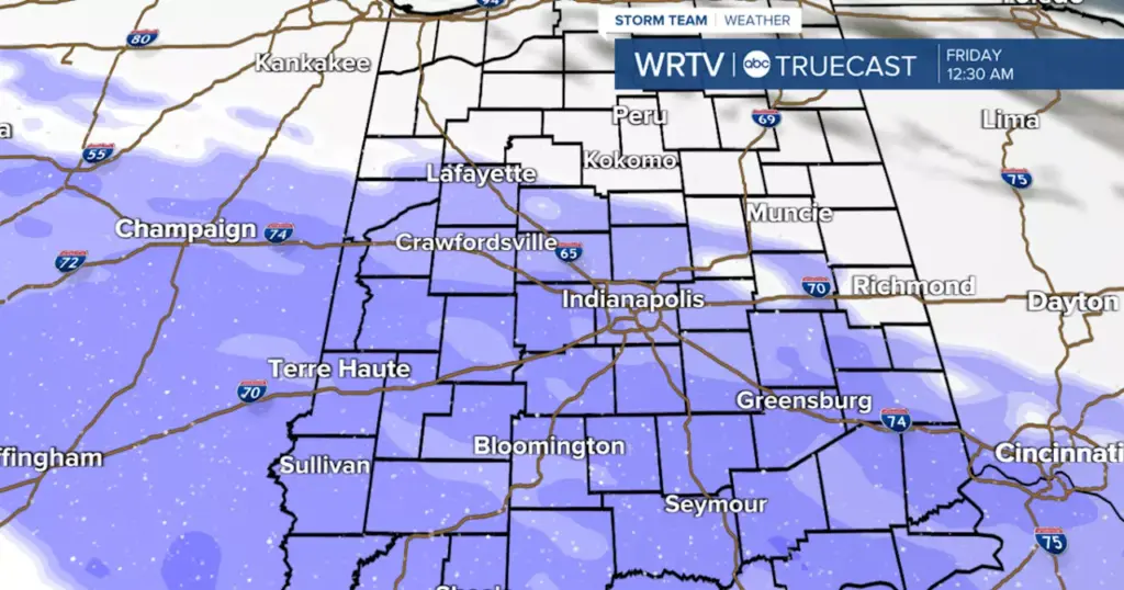
A strong weather system is moving in, bringing snow that could impact the evening commute, particularly in western areas. By late Thursday, snow is forecasted to spread across much of Central Indiana, with predictions indicating 1 to 3 inches of snow along and southwest of a Lafayette to Richmond line, and possibly 3 to 5 inches in central and southern regions.
Temperatures will drop to around 25°F overnight, while the day will remain gray and cloudy, with highs only reaching around 31°F. Earlier Thursday, flurries may be seen, but the bulk of the snow will arrive in the evening.
Residents should remain cautious as conditions deteriorate. Meteorologists are advising that the snow could significantly affect driving conditions Thursday night into Friday morning.
As the winter weather continues, another round of light snow is likely on Saturday, accompanied by the coldest air of the season. Highs may plummet to the single digits on Sunday, with even colder wind chills expected, making it vital for everyone to remain vigilant during this severe weather pattern.
Most notably, this storm could bring with it the harshest winter conditions seen this year, making it crucial to stay informed and prepared. For those traveling, it is recommended to check road conditions and adjust plans accordingly.
Stay tuned for further developments as this situation evolves.
Indianapolis Weather Forecast:
– **Tonight:** Cloudy. Low: 25°F
– **Thursday:** Cloudy with flurries possible. High: 31°F
– **Thursday Night:** Snow likely. Low: 26°F
– **Friday:** Mostly cloudy. High: 33°F
– **Saturday:** Light snow likely. High: 19°F
This weather update is brought to you by the WRTV Storm Team. Stay safe and prepared as winter weather impacts Central Indiana.