NASA’s Mars Reconnaissance Orbiter (MRO) has provided new insights into a long-standing mystery beneath the Martian surface. Using an innovative radar technique, scientists have re-evaluated a region previously thought to contain a liquid water lake, concluding it is likely a layer of rock and dust instead. This finding could have significant implications for future explorations of Mars, particularly in the quest for subsurface resources.
In 2018, the European Space Agency’s Mars Express detected a signal from beneath Mars’ south polar ice cap, indicating the possible existence of an underground lake. This discovery sparked extensive scientific investigation, as the presence of liquid water is closely tied to the potential for life beyond Earth. The latest study, led by scientists Gareth Morgan and Than Putzig from the Planetary Science Institute, has shifted the narrative, suggesting that the radar signal detected may be less about water and more about geological features.
The MRO’s observations relied on a special maneuver that rolled the spacecraft 120 degrees. This technique enhanced the capabilities of the Shallow Radar (SHARAD) instrument, allowing it to penetrate deeper into the Martian subsurface and provide a clearer picture of what lies beneath the ice. The targeted area, approximately 12.5 miles wide and buried under nearly 1 mile of ice, was previously challenging to study due to the limitations of the radar signal.
Putzig remarked, “We’ve been observing this area with SHARAD for almost 20 years without seeing anything from those depths.” The newly developed roll technique enabled the team to receive a much fainter radar signal than expected, contrasting with the strong reflections detected by the Mars Advanced Radar for Subsurface and Ionospheric Sounding (MARSIS) instrument aboard Mars Express in 2018. The discrepancy raises questions about the unique conditions present at the site of the original signal.
The findings suggest that the bright signal previously interpreted as liquid water could instead represent a smoother geological feature, possibly an ancient lava flow. “While this new data won’t settle the debate, it makes it very hard to support the idea of a liquid water lake,” Morgan stated. This shift in understanding highlights the complexity of Martian geology and the challenges of interpreting radar data from such depths.
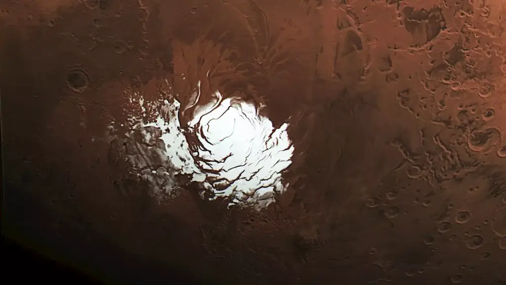
Mars’ south pole is characterized by a thick ice cap overlaying a heavily cratered landscape. Most radar images from the region reveal a topography filled with peaks and valleys, complicating the search for water. Going forward, Morgan and Putzig express excitement about utilizing the enhanced rolling technique to explore other scientifically relevant areas on Mars, such as the Medusae Fossae formation. This region, located near Mars’ equator, has produced minimal radar returns, leading to speculation about its composition.
If further investigations reveal ice in this area, it could indicate substantial water resources near the equator, a prime location for potential human exploration. “The equator is exposed to more sunlight, it’s warmer and ideal for astronauts to live and work,” Putzig added.
NASA’s Jet Propulsion Laboratory in Southern California manages MRO, which has been orbiting Mars since 2006. The spacecraft was built by Lockheed Martin Space and operates under the auspices of NASA’s Mars Exploration Program. The SHARAD radar was provided by the Italian Space Agency, showcasing international collaboration in Mars research.
As scientists continue to analyze data from MRO and similar missions, the quest to understand Mars’ geological history and potential for life remains at the forefront of planetary exploration. The latest findings underscore the importance of innovative techniques in unraveling the complexities of the Red Planet.