Researchers at the State University of Campinas in Brazil have developed an innovative technique that uses artificial intelligence (AI) to measure the forces acting on individual grains of sand on Mars. This groundbreaking method aims to reveal how wind has shaped the Martian surface, providing insights into the planet’s atmospheric history.
Revealing the Forces Behind Dune Formation
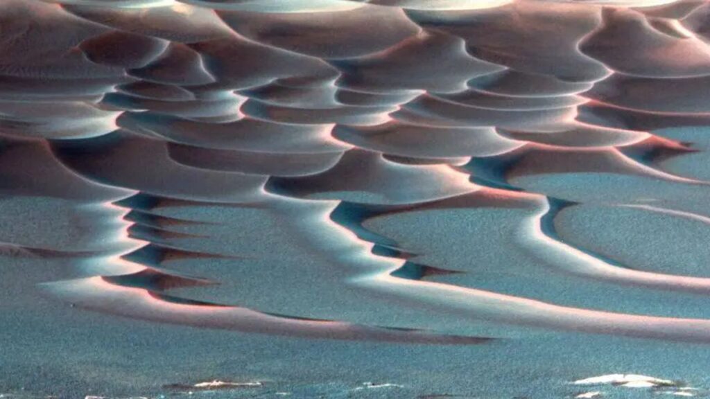
The team’s approach combines laboratory experiments, computer simulations, and AI to generate detailed force maps that illustrate the physics of dune formation. Dunes, especially the crescent-shaped barchan variety, form wherever wind or water interacts with loose sand, whether on Earth or the dusty plains of Mars. By tracking these formations, scientists can infer prevailing winds and environmental conditions.
Until now, quantifying the forces driving the motion of individual grains of sand was a challenge. “To measure the force acting on each grain, you’d need to place a tiny accelerometer on each one, which simply doesn’t exist,” the researchers explained. To address this, they recreated miniature underwater dunes in a laboratory setting and executed detailed 3D simulations to calculate the exact forces at play.
Artificial Intelligence Enhances Image Analysis
Through this process, the researchers trained a convolutional neural network, a type of AI commonly used for image recognition, to correlate dune images with the corresponding force maps generated from simulations. Once trained, the AI proved capable of inferring the distribution of forces based solely on visual data. When tested on new dune images, it accurately predicted the forces involved, even for shapes it had not previously encountered.
“Any granular system that can be seen in an image — whether ice, salt, or synthetic particles — can be analyzed as long as there’s a simulation capable of accurately reproducing the behavior of the material,” said Renato Miotto, a postdoctoral researcher and lead author of the study.
This ability to extract intricate physical information from images alone opens up a range of possibilities. On Earth, the methodology could assist engineers in predicting coastal erosion, river sediment transport, or the behavior of granular materials in various industrial applications. Additionally, this technique can be applied to other celestial bodies, like Mars, which is imaged from orbit.
“In the case of Mars, it’s possible to infer, from widely available images, the intensity of winds in the past and the evolution of dunes in the future,” stated Erick Franklin, professor and co-author of the study. This new method not only enhances our understanding of the Martian environment but also provides a fresh perspective on studying the Red Planet’s atmospheric history and surface evolution.
The findings of this research were published on August 1, 2023, in the journal Geophysical Research Letters, marking a significant advancement in planetary science and our understanding of Mars.