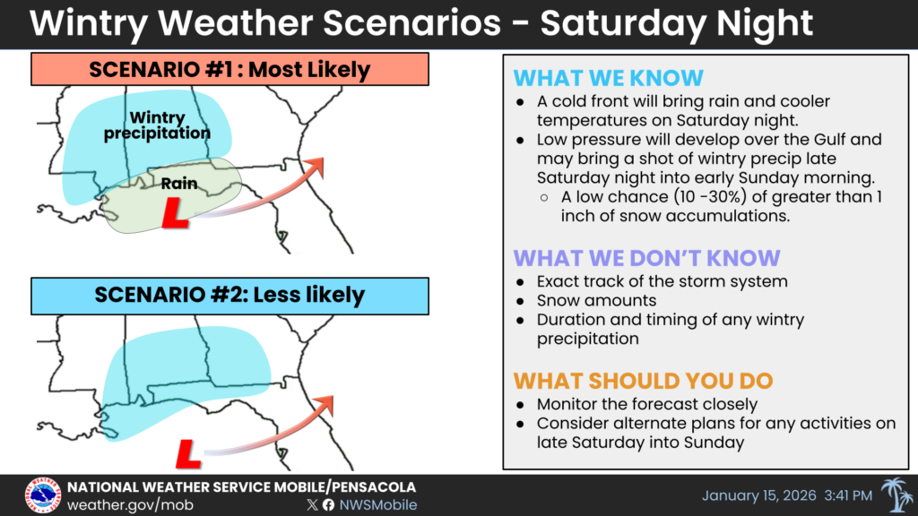
UPDATE: The National Weather Service (NWS) in Mobile has issued an urgent weather forecast for Saturday night, indicating a significant potential for snow across the region. Just released at 4 p.m. Thursday, the report outlines two possible scenarios that could impact local residents.
Scenario One suggests that low pressure may fail to form over the northern Gulf or track further north. In this case, expect light rain Saturday evening transitioning to a wintry mix and possibly snow overnight. Accumulations from this scenario are expected to be light, with the most likely totals being less than 0.5 inch. The reasonable worst-case scenario could see accumulations reach 0.75-1 inch in some areas.
In contrast, Scenario Two—though less likely—forecasts low pressure forming over the northern Gulf and tracking further south. This would lead to light rain transitioning to a wintry mix and snow for a longer duration. If this scenario materializes, snow accumulations could range from 0.75-1 inch, with a reasonable worst-case scenario predicting up to 1-2 inches of snow, especially east of I-65.
The NWS is closely monitoring the situation and will provide updated projections to local emergency management agencies around 7 a.m. Friday. Residents are urged to stay informed and prepare for potentially hazardous conditions.
With winter weather on the horizon, this forecast not only affects travel plans but also poses risks for local communities. As conditions evolve, the potential for brief heavy snow could create sudden challenges for drivers and residents alike.
Stay tuned for updates as this developing situation unfolds, and prepare accordingly for a winter mix that could disrupt Saturday plans.