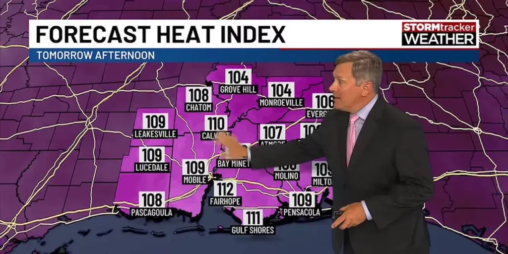
UPDATE: The Gulf Coast is experiencing an intense heatwave, with temperatures soaring as high as 95°F (35°C) early this week. New reports from the National Weather Service confirm that while dry conditions persist, the region should brace for significant rain chances returning later this week.
As of today, October 16, 2023, a drier air mass has settled over the Gulf Coast, contributing to the ongoing heat. Residents in cities like New Orleans and Mobile are feeling the impact, with many facing discomfort as the heat index climbs.
Authorities emphasize the urgency of staying hydrated and taking precautions against heat-related illnesses. “The combination of heat and humidity can be dangerous,” warned a spokesperson from the National Weather Service. “We urge everyone to stay safe and monitor local forecasts closely.”
However, relief may be on the way. Meteorologists are tracking an incoming weather system that could bring moisture and rainfall starting late Thursday into the weekend. This shift could significantly alter conditions, providing much-needed respite from the heat.
In addition, the tropics remain active. The National Hurricane Center is monitoring several disturbances that could impact the Gulf Coast in the coming days. The potential for tropical storms raises concerns for residents and officials alike, urging preparedness for possible severe weather.
As temperatures continue to soar, the community’s well-being is at the forefront of local authorities. They are advising residents to remain vigilant and be ready for any weather changes. As the situation develops, updates will follow to inform the public about the latest forecasts and safety measures.
Stay tuned for further developments, as the Gulf Coast braces for a potential shift in weather patterns later this week.